Myriahedral bibliography and source provenance
Documentation index · Geometric context · Implementation notes
Foundational publication
Jarke J. van Wijk, “Unfolding the Earth: Myriahedral Projections,” The Cartographic Journal, volume 45, issue 1, pages 32–42, 2008.
- Author-hosted paper and project page
- Paper PDF
- DOI: 10.1179/000870408X276594
- TU/e Research Portal record
This is the primary description of subdividing a sphere into many faces, optimizing cuts through the dual graph, and unfolding the resulting tree into a planar map.
Previous implementation
Hannes Schulz and contributors,
temporaer/myriaworld.
The repository describes itself as a rugged implementation of van Wijk’s method. The C++20 code in this repository reimplements its relevant forward geometry cleanly; it does not copy its runtime architecture or retain its external dependency chain.
Important primary files and records:
- README and documented example command
SPHEmesh.cpp: icosahedron and recursive face ordercutting.cpp: minimum spanning tree and flattening traversalgeo.cpp: triangle-to-triangle coordinate transferread_shapefile_data.cpp: mesh graph, smoothing, and edge weighting
The pinned revision is the upstream head inspected while implementing this projection. Pinning makes line history and algorithm provenance reproducible.
Configuration evidence and adopted tree
The upstream README publishes this example:
./myriaworld --depth 5 --sigma 0.4 --wlon 3. \
  --output test --alpha 1 --rotate 0 \
  --clat 313 --clon -65 --roll -315 --render png
That command is valuable evidence for the intended depth, preprocessing pipeline, and available controls. It does not generate a tree that aligns with the black-and-white sample’s visible geographic branches. The upstream repository does not preserve a command line alongside each sample asset, and the configuration question remains recorded in upstream issue #2.
For this implementation, the historical preprocessing was reproduced with
the exact face overlap data and candidate trees were compared against visible
geographic anchors in the requested raster. The adopted compatibility
configuration is depth 5, Gaussian sigma 0.7, wlat=0.5, wlon=0.1,
clat=-60, clon=-65, full flattening, and a final 335 degree rotation.
It is reproducible and visually registered, but it is not represented as the
unrecoverable original command that created the PNG.
Geographic source data
Natural Earth provides public-domain map data at several scales. The historical workflow used the 1:10m countries and ocean datasets to estimate land coverage and choose favorable cuts.
Natural Earth and S2 geometry are preprocessing provenance only. Neither is a
runtime dependency of a60::carto::myriaproj.
Local base raster
The registration asset is:
assets.static/myriahedral/black-white-downsampled.png
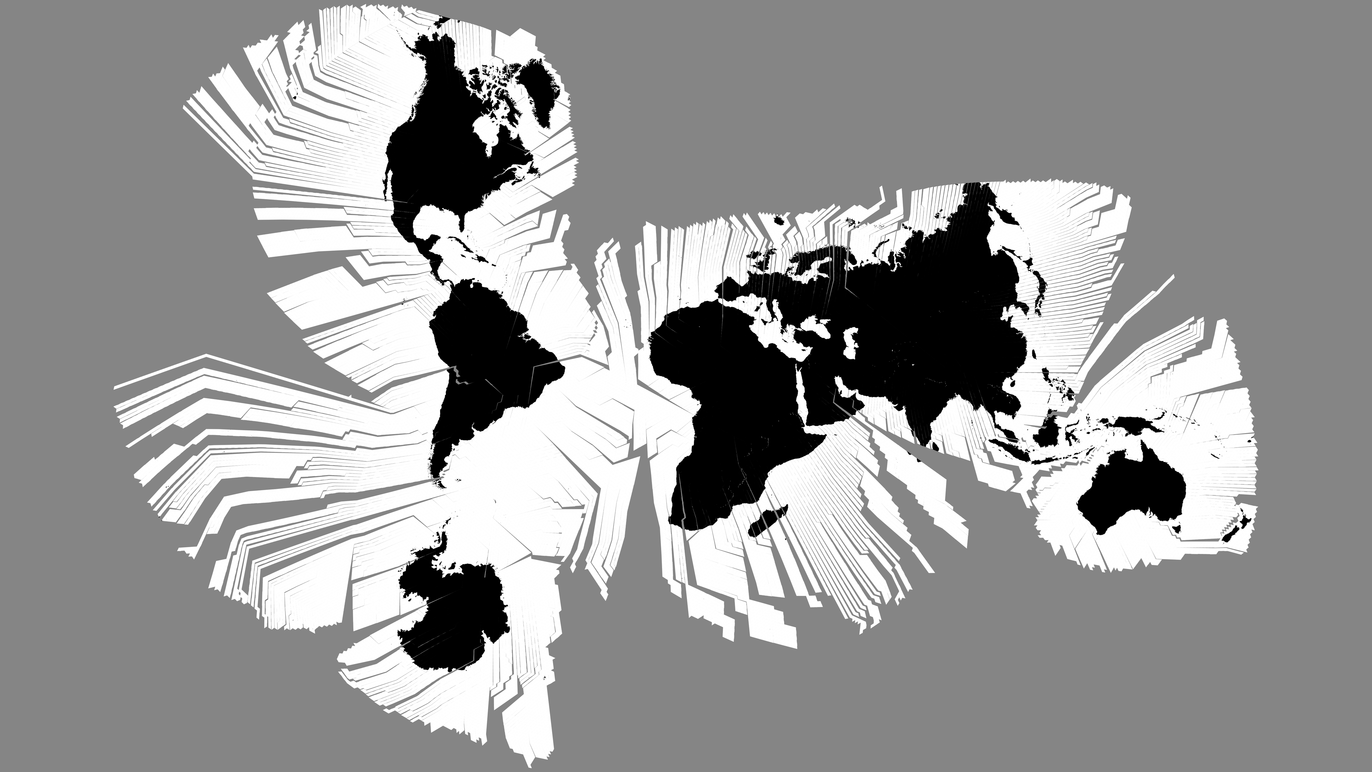
Properties verified during implementation:
| Property | Value |
|---|---|
| Dimensions | 4480 x 2520 pixels |
| Canvas ratio | 16:9 |
| Color model | 8-bit grayscale PNG |
| SHA-256 | 1228cae3fdcbdcb867952135e9eeaec7d894c092eb8dae828d0dd61ad8658fd7 |
The digest is identical to the upstream
samples/black-white-downsampled.png
at the pinned revision.

The raster supplies visual context and the 16:9 registration canvas. It is
not sampled or used as a numeric lookup table by the forward transform. The
current implementation deliberately uses van Wijk’s central gnomonic
face-local method rather than preserving the historical program’s orthogonal
chord-plane approximation, so subpixel coordinate differences from the
raster’s generating lineage are expected and documented.
Licensing note
The cartofreako implementation is distributed under the license stated in
its source headers and repository. The upstream author stated in
myriaworld issue #1 that
the code and sample image could be used under BSD terms. At the inspected
revision, however, the upstream repository did not contain a standalone
LICENSE file. That issue comment is therefore the available upstream record,
not a substitute for legal advice or a newly invented license text.
Natural Earth states that its data is in the public domain. Van Wijk’s paper is cited for the projection method; no paper text or figure is incorporated into the implementation.
Related local documentation
- Implementation notes contain the exact formulas, fixed-tree design, API, scaling, tests, and limits.
- Geometric context illustrates the primal mesh, dual tree, cuts, quadrants, axes, and source-canvas relationship.
assets.static/myriahedralpreserves the exact reconstruction artifacts and checksums used by the implementation.